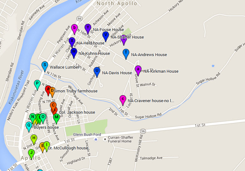
The “Truby Farmhouse” interactive map of historic sites in Apollo & North Apollo is gradually expanding. I’ve now added most of the houses from North Apollo that were mentioned in the county report. Visit the map and click on the markers to open up photos and brief descriptions of each location.
This map currently includes only the houses and buildings listed in the 1980-81 Armstrong County Historic Sites Survey, as discussed in earlier blog posts. I may create additional maps, or add to this one, to cover other historically important houses, especially those related in some way to Simon Truby’s farm.
Enjoy! And please let me know if you find any mistakes, or have suggestions or comments.
Click here to visit the interactive map .

Subscribe to the Truby Farmhouse blog to receive emails whenever new articles are posted.
Please help to preserve Apollo’s history by making a donation to the Apollo Area Historical Society at https://apollopahistory.wordpress.com/donate/ .
Come check out Apollo’s History Walk along Roaring Run Trail on Sun July 3. I’ll have a table with info about Apollo’s architectural styles and also the Truby farm, family, and farmhouse. Plus, you can visit other tables as you stroll along through Apollo’s 200 years of history.

This is so interesting, Vicki! I love the interactive part!
LikeLiked by 1 person